El Tossal Trail

ROUTE:

2.8 km

DURATION:

1 hour 30 minutes

DIFFICULTY:

Easy
Recover the Mountain

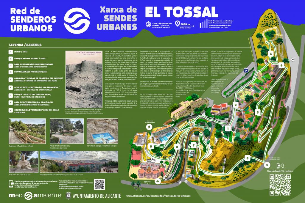
El Tossal, also known as Monte Tossal, is a promontory with a height of 87 meters above sea level, where the San Fernando Castle is located. El Tossal is embraced by the Alicante neighborhoods of San Blas, Mercado and Campoamor, representing an enclave of significant environmental value for the City.

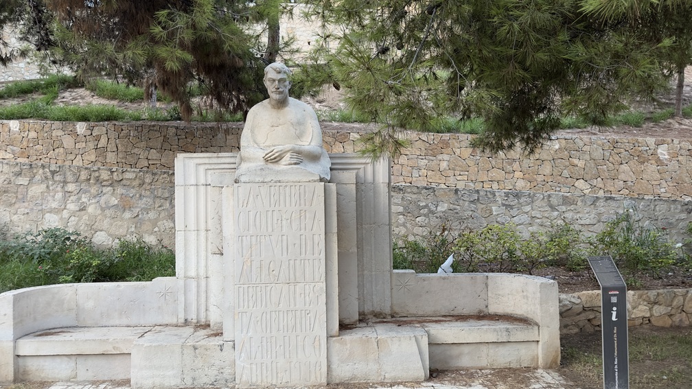
In 1911, the Alicante doctor Antonio Rico Cabot, being a councilor, proposed to the City Council to acquire the mountain of San Fernando Castle, a barren and desolate promontory, to reforest it with pines and turn it into a green lung and recreational area for the population. Dr. Rico recommended that Alicante should not invest anything, but that the councilors and the mayor should provide the capital due to the lack of funds in the municipal coffers. The project would go ahead, with the City receiving four-fifths of the total land and later the remaining fifth, with a total investment of 50,000 pesetas at that time. ‘Its forest repopulation would cost the Town Hall nothing as it was undertaken by the Tree Protection Society.’

All Routes in Alicante

Route A

Maritime facade of Alicante

Route B

Santa Barbara Castle

Route C

Old Town of Alicante

Route D

The Traditional Downtown of Alicante

Route E

Alicante Air Raid Shelters

Services that might interest you

AGUITUR
Tourist guides accredited by the Valencian Agency of Tourism
ALACANT CIRCUIT

icono +34 601 039 933
icono +34 685 829 937
icono info@alacantcircuit.com
icono www.alacantcircuit.com

Tourist guides accredited by the Valencian Agency of Tourism
BLUEMED TOURS S.L

icono C/ Pintor Aparicio, 28 E-1, 03003, Alicante
icono +34 679 899 880
icono central@bluemedtours.com
icono www.bluemedtours.com
Facebook Instagram

SICTED Badge
The Exquisite Mediterranean
CREATURISME VALENCIAN COMMUNITY CULTURAL
CRATURISME VALENCIAN COMMUNITY WINE TOURISM
CONVENTION BUREAU ALICANTE
ALICANTE WINE ROUTE

Tourist guides accredited by the Valencian Agency of Tourism
Languages: English, Spanish, French, Valencian
Esatur XXI, S.L.

icono Calle Arzobispo Loaces, 3, 03003, Alicante
icono +34 966 377 034
icono info@esatur.com
icono www.estaturservicios.com
Facebook Instagram

Distintivo SICTED
ISO 9001
ISO 14001
ISO 27001
Tourist guides accredited by the Valencian Agency of Tourism
Languages/ Languages: English, Español, Valencià
FREE WALKING TOURS ALICANTE
Facebook Instagram Tripadvisor

Tourist guides accredited by the Valencian Agency of Tourism
OXYTOURS
Facebook Instagram X tripadvisor

Guías de Turismo acredidatos por la Agencia Valenciana de Turismo
Tourist guides accredited by the Valencian Agency of Tourism
TRAMUNTANA AVENTURA

icono C/ Rabasa, 3, Local 1, 03005, Alicante
icono +34 686 216 102
icono info@tramuntanaaventura.es
icono www.tramuntanaventura.es
Facebook Instagram Tripadvisor

Q Certificate for Tourist Quality
Sicted Certificate

Tourist Guides accredited by the Valencian Agency of Tourism
Tourist guides accredited by the Valencian Agency of Tourism
TURIGUIAS

icono C/ del Teatro 41, 4 IZQ, 03001, Alicante
icono +34 686 469 916
icono +34 654 486 777
icono contact@turiguiasalicante.com
icono www.turiguiasalicante.com
Facebook Instagram

SICTED Quality Certificate

Tourist guides accredited by the Valencian Agency of Tourism
ULA Guides

icono Marina Deportiva, Mlle. Levante, 6, 03001, Alicante
icono +34 677 299 150
icono ula_sp@hotmail.com
Facebook Instagram

SICTED Distinctive

Tourist guides accredited by the Valencian Agency of Tourism
Languages/ Languages: Deutsch, English, Español, Français, Italiano, Valencià, others

Alicante By Bike & Rentals Tours

icono C/ Cienfuegos, 1, 03002, Alicante
icono +34 605 097 063
icono info@alicantebybike.com
icono www.alicantebybike.com
Bike Rent in Alicante

icono C/ Bailén, 14, Local 1, 03001, Alicante
icono +34 605 657 496
Blue Bike | Rental & Tour

icono C/ Mayor 45, 03002, Alicante
icono info@bluebike.es
icono www.bluebike.es
Rent Point- Rent Bike Alicante

icono C/ Navas 11, 03001, Alicante
icono +34 658 348 218
icono rentpointalicante@gmail.com
icono www.rentpointalicante.com
Bikes&City Alicante – Alquiler, rutas

icono C/ San Vicente 61, 03004, Alicante
icono +34 966 376 596
icono www.bikesandcity.com

BLUE BIKE ALICANTE

icono C/ Mayor, 45, 03002, Alicante
icono +34 674 676 362
icono www.bluebike.es
ESATUR
SEGWAY ALICANTE

icono +34 656 332 485
icono +34 966 272 837
SIS TOURS EVENTS

Facebook

TRAMUNTANA AVENTURA

icono C/ Rabasa, 3, 03005, Alicante
icono +34 686 216 102
icono +34 616 35 1506
icono info@tramuntanaaventura.es
icono www.tramuntanaaventura.es

AKRAVIBE

icono C/ Castaños, 42, 03003, Alicante
icono +34 965 168 907
icono www.akravibe.es
AVENTURERO CATAMARÁN S.L

icono Av. Conde de Vallellano, s/n, 03001, Alicante
icono +34 694 443 820
icono info@alicantecatamaran.com
icono www.alicantecatamaran.com
ALICANTE RACING QUADS RENT

icono Mlle. Poniente, 6, 03001, Alicante
icono +34 697 207 904
icono alicanteracingquads@gmail.com
ALIJETSET

icono Mlle. Levante, 8, Local 4, 03001, Alicante
icono +34 627 031 220
icono +34 660 731 819
icono info@alijetset.com
icono www.alijetset.com
AWANA

icono Av. Condomina 70 BL5 E15, 03540, Alicante
icono +34 636 852 977
icono info@awanamountains.com
icono www.awanamountains.com
BLUE VALLEY

icono Av. Costa Blanca, 114, 03540, Alicante
icono +34 635 230 672
icono +34 645 392 021
icono info@bluevalleyco.com
CENTRO BUCEO ALTAIR

icono C/ Rosa Chacel, 20 local D, 03008, Alicante
icono +34 634 959 013
icono buceoaltair@gmail.com
icono www.alicantebuceo.es

Facebook
Instagram
CLUB DE SURF EL MORENO

icono C/ Deportista Juan Mato, 4, 03016, Alicante
icono +34 649 556 696
icono elmorenosurf@gmail.com
icono www.clubsurfelmoreno.com
EPICALBOATS

icono Marina Deportiva, 03001 Alicante
icono +34 605 729 918
icono info@epicalboats.es
icono www.epicalboats.es
ENERGY ACTIVE CLUB

icono Av. de la Costa Blanca, 114, 03540, Alicante
icono +34 635 230 672
icono www.energyactiveclub.com
FANAUTIC CLUB ALICANTE

icono C/ Currica, 1, 03590, Alicante
icono +34 639 661 398
icono alicante@fanauticclub.com
icono www.fanauticclub.com

Facebook
Instagram
X
HIKINGALICANTE

icono C/ Miraflor 1, 03005, Alicante
icono +34 660 507 225
icono info@hikingalicante.com
icono hikingalicante.com


Instagram
X
LLOGA UN LLAÜT

icono Mlle. de Levante 8, s/n, 03113, Alicante
icono +34 680 191 313
icono info@llogaunllaut.es
icono www.llogaunllaut.es
MARINA JETS S.L

icono Mlle. de Levante Tinglado 21A, 03002, Alicante
icono +34 602 585 243
icono marinajets.sl@gmail.com


Instagram
OXYTOURS

Facebook
Instagram
X
Tripadvisor
PARASAILING ALICANTE

icono Mlle. 14, Zona de Levante, S/N, 03001, Alicante
icono +34 674 444 747
icono info@parasailingalicante.com
icono reservas@parasailingalicante.com
icono www.parasailingalicante.com
Facebook
Instagram
SIS TOURS EVENTS

icono Av. Miriam Blasco, 2, 03540, Alicante
icono +34 627 168 907
icono +34 609 291 993
icono info@sistorsevents.com
icono www.sistoursevents.com

Facebook
X
TERRENODEAVENTURA

icono C/ Enric Valor 12-73 03540 Playa de San Juan (Alicante)
icono +34 687469836
icono terrenodeaventura@gmail.com
icono www.nativojaime.blogspot.com
TRAMUNTANA AVENTURA

icono C/ Segura, 13, Bajo derecha, 03004, Alicante
icono +34 686 216 102
icono info@tramuntanaaventura.es
icono www.tramuntanaventura.es

ALICANTE RACING QUADS RENT

icono C/ de Sant Agustí, 3, 03002, Alicante
icono +34 697 207 904
icono alicanteracingquads@gmail.com
OXYTOURS

Facebook
Instagram
X
Tripadvisor
TRAMUNTANA AVENTURA

icono C/ Rabasa, 3, 03005, Alicante
icono +34 686 216 102
icono +34 616 35 1506
icono info@tramuntanaaventura.es
icono www.tramuntanaaventura.es

* Important Notice

The Alicante Municipal Tourist Board is not responsible for any changes that may occur in the contact details, schedules, locations of accommodations, restaurants, tourist service companies, and transport, as well as in the cultural facilities of the city. It is recommended to verify the information in advance.

Events calendar

No event found!

In the second half of the 20th century, works would be carried out for the recovery of spaces and recreational-educational uses in the Tossal, such as the installation in 1963 of what was the children’s traffic park or, in 1995, the theme park on the eastern slope of the mountain which, after a decade, was partially rebuilt.

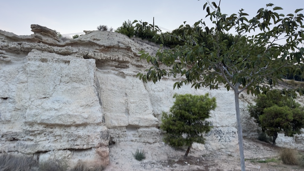
As 2018 progressed, the Town Hall would initiate the works of the Execution Project for the erosion correction and adaptation of degraded forest areas in the Tossal (FEDER – EDUSI Alicante Funds). The consolidation of slopes has been combined with the creation of trails that facilitate pedestrian transit, connecting the facilities and the neighborhoods in the area. A process of flora recovery has been carried out, acting in the most depressed areas of the mountain, with trees, shrub and herbaceous plants characteristic of the Mediterranean forest, applying sustainability criteria with the improvement of irrigation by using reclaimed water. The relevance of geology in the Tossal has meant that the works carried out took into account the heritage value of some outcrops, fostering the history told by its Quaternary rocks.

1. Start

0 meters

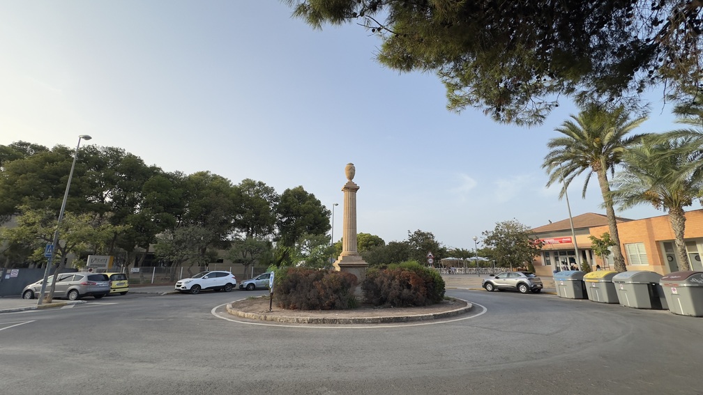
We start the route in front of the roundabout, where the monument to the Heroes of the War of Independence is located, at the junction of Calle Catedratico Jaume Mas i Porcel and Calle Escultor Bañuls.

2. Monte Tossal Park

50 meters

We are at the facilities of the ‘Monte Tossal’ park; inaugurated in the spring of 1995, its morphology simulated the Valencian Community, hence it was called ‘thematic’, divided into its different regions, with a layout of terraces characteristic of traditional crops. The plant species, according to the initial project, were to be representative of those existing in the bioclimatic zones of the autonomous community. All this combined with recreational areas where material was provided for the various games in this park, which was a pioneer in the recreational-educational services of the large parks in Alicante. We continue along the sidewalk heading north, on the right we have the skatepark and ahead we see the football stadium. A few meters further, slightly to the right, we take the transformer booth of the repeaters as a reference.

3. Area of differentiated routes

400 meters

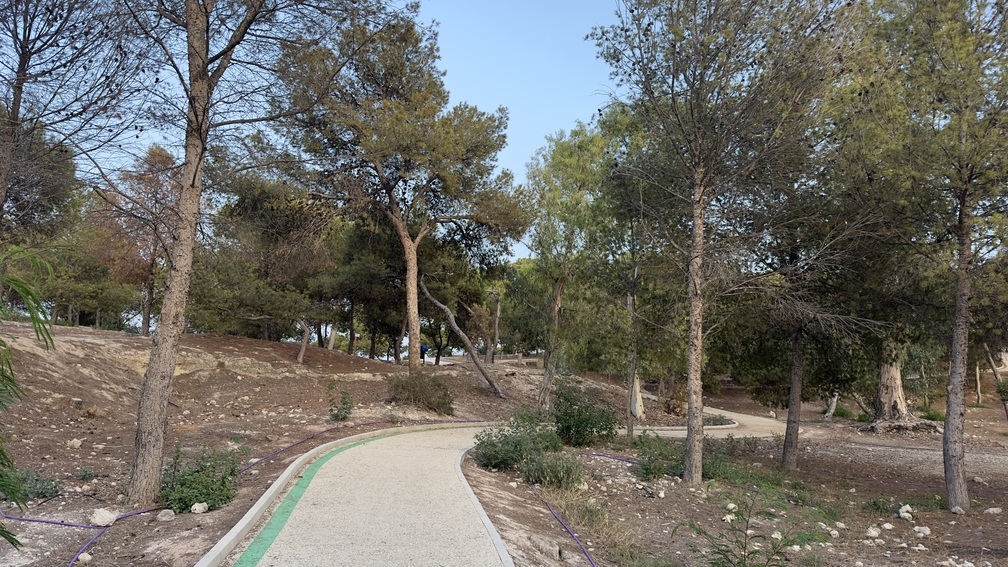
We walk around the small hut and follow a wooden railing, entering a network of trails that are marked by colored lines on the ground—red, blue, or green—indicating the difficulty or incline of the interconnected paths. At the first crossroads between the main road and our trail, we find a space dominated by a eucalyptus tree (Eucalyptus camaldulensis). This spot was once home to an ancient spring known as Fuente Santa. In 1260, Alfonso X, known as “the Wise,” invested 500 maravedis “to help bring water from Fuente Santa to your town,” using the existing qanat system. This spring, which supplied water to the city for several centuries, was later renamed Font del Traves and, eventually, Casa Blanca. We continue along the first inner path to the right, heading southeast. Further ahead, we climb a set of stairs, using the hut-transformer tower as a visual reference point.

4. Panoramic views

200 meters

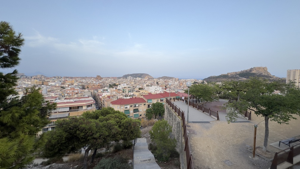
We turn left and in the opposite direction, we descend a ramp until we reach a point that can serve as a viewpoint. The nearest image is that of the neighboring Barrio Campoamor. As a background landscape, and starting a visual tour from northeast to east, we can see some of the mountains of Alicante as the Carrasqueta, the Cabeço d’Or, Aitana, and Puig Campana. Already in the city, we see the Serra Grossa with Cerro el Molinet and then Monte Benacantil with Santa Barbara Castle on its summit. Our route continues south, flanked by mulberry trees (Morus alba) and pines (Pinus halepensis) which, as the route progresses, are also combined with Ficus microcarpa, known as Indian laurel. But, in addition to these trees aligned with the mission of providing shade, in this part of the hillside, we can easily identify other species with a more ornamental function as the tree of love or Judas (Cercis siliquastrum) or whose size attracts attention as the araucaria excelsa or Norfolk Island pine (Araucaria heterophylla).

5. Grove and connecting paths of the Park
250 meters

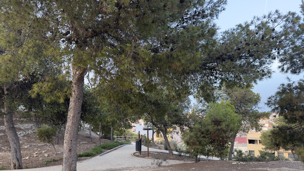
At the fork, we go down on our left and, shortly after, turn right onto the path that crosses until we reach the vicinity of Calle Ronda del Castillo. In this section of the trail, we find secondary paths that can be easily walked and that connect with the surrounding neighborhoods, unique stairways with sleepers, an elevated walkway, and auxiliary elements that complement the trail.

6. East Access – San Fernando Castle

500 meters

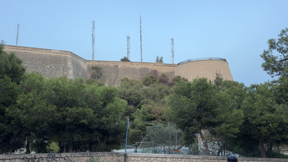
Ascending slightly, we approach San Fernando Castle, named after King Ferdinand VII and hastily constructed between 1809 and 1813 to resist Napoleonic invasion. Looking up, we first see the northernmost bastion. We skirt the conical bastion, leaving the ramp to the fortress on our right. Heading northwest, we take the left trail at a fork, which descends into the park.

7. Park – Bust of Dr. Rico

450 meters

We pass by the restored bust of Dr. Rico, a work of sculptor Daniel Bañuls carved in limestone and installed in the park in 1930, in recognition and honor of this doctor from Alicante who in 1911, thanks to his perseverance and being a councilman, proposed to the Consistory to acquire the Tossal de San Fernando to turn it into a green lung and recreation area for the population. In the adjoining and lower terraces, was installed the old children’s traffic park in which, between the 60s and 80s of the last century, Antonio Pomares, affectionately known as “Sargento Moquillo”, taught road traffic rules to girls and boys who were behind the wheel of a pedal car, tricycle or bicycle. We headed towards the access to the roadway and a few meters away we crossed the crosswalk that links the southwest side of the hill. After some steps, we begin a small ascent in a northerly direction, and at the first crossing we turn in the opposite direction; we continue along a pleasant path with benches, appreciating rows of oleanders (Nerium oleander) on the margins, mulberry trees, pines and

8. Geological interpretation area

200 meters

In front of a continuous rock wall, we find an interpretive panel about the geology of Tossal, which also helps us understand the geological history of Alicante. To our left, there is a small path, but we continue straight ahead. From here, we enjoy a view of the downtown with the Mediterranean Sea in the background. A few meters further, we turn right next to a triangular planter. We enter an area filled with mastic trees (Pistacia lentiscus), saltbush (Salsola oppositifolia), esparto grass (Stipa tenacissima), carob trees (Ceratonia siliqua), and olive trees (Olea europaea), blending with the pine forest—a result of recent reforestation efforts. A short distance ahead, we find another geological interpretation point, where we can observe different types of limestone rocks, such as tufa and travertine, which formed in environments associated with watercourses. Fossilized plant remains can also be seen in these rocks. We now stand behind the IES Jorge Juan school, established on the Tossal in 1953. However, its origins date back to the mid-19th century when it was founded as the Provincial Public Secondary School, beginning its activity in the ‘La Asegurada’ mansion. This marked the start of secondary education in Alicante. Further ahead is the IES Miguel Hernandez, which began as a girls’ school in 1963, initially sharing facilities with IES Jorge Juan for three years. To our right, we ascend some steps leading to a path that splits in two.

9. Cross of the Century and Viewpoint

300 meters

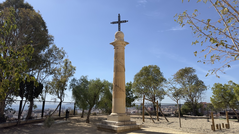
Taking the right path brings us to a viewpoint. If we take a short detour to the left, we reach the back of the Practicas – La Aneja school, where we find the Cross of the Century. This monument was inaugurated in 1901 to commemorate the arrival of the Santa Faz relic in Alicante and the beginning of the new century. The Cross was destroyed by dynamite in 1934 but rebuilt in 1939.
At the viewpoint, we can see the city extending southward, with the bay and Cabo de Santa Pola in the distance. Looking west, we spot Sierra Sancho and Sierra Borgunyo, with the Fontcalent range standing out. Much of what we see relates to geology. Beneath us lie over 20 meters of tufa limestone formed by an ancient river system that shaped the Quaternary landscape thousands of years ago. We continue along the path next to the wall bordering the CEIP Practicas – La Aneja, a public school located in the former premises of the Teacher Training School from 1964. We skirt the school, following a trail equipped with a rustic handrail. At the next fork, we take the left path, leading to a rest area and the former Railway Orphans’ School, which closed in June 1990 and now houses the Conservatory. Finally, we pass by the Tourism Center and return to the starting point of our trail.